Geophysics at Oakwell Hall
 Written by: Joe Murray, Assistant Curator (Archaeology)
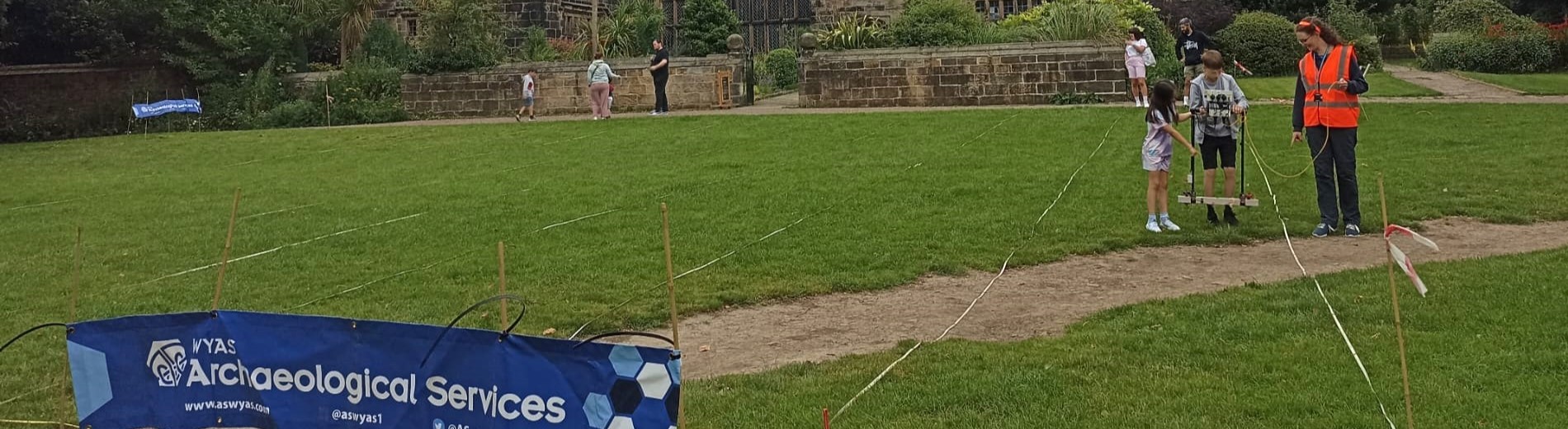
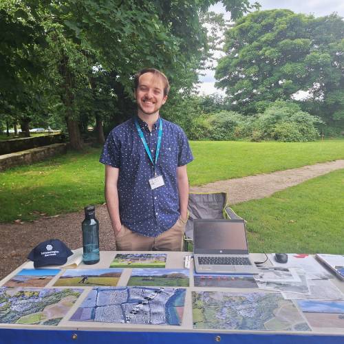
Between May and July 2024 a team of Archaeologists who are experts in Geophysics descended on Oakwell Hall. Their aim, to engage with visitors to the park and try to create a picture of what lurks beneath the soil.
Geophysics is a broad term used to describe physics-based science used on the earth. In archaeology this attempts to detect what lies directly beneath the soil that has been affected or created by the people of the past. There are a number of different techniques used in geophysics, but the two techniques that have been the focus at the Hall are Magnetometry and Resistivity.
Magnetometry
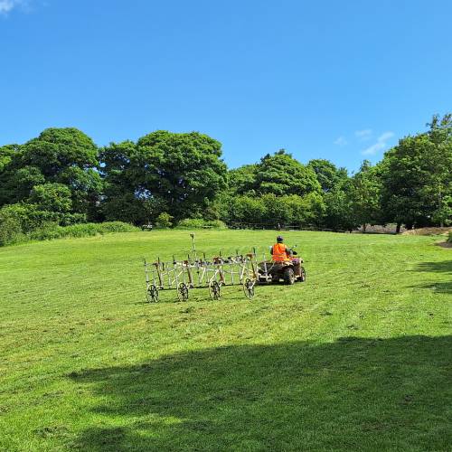
Magnetometry employs the power of magnetism to create an image. To begin with, the archaeologists have to measure the local magnetic field to get a base line reading. Once they have this reading, they can measure any magnetic disturbances in the ground in comparison to this base line to get a numerical result. This is done by using sensors that have been fixed to a frame and moving the frame around a prearranged grid. Where there have been disturbances in the soil the machine will give a different reading from the baseline result. For example, where a ditch has been dug and refilled with soil and rubbish. This can take some time when surveying a large area. To combat this the Archaeologists have come up with a high-tech solution, pulling the sensors behind a kart!
This technique is able to reveal features such as ditches, roads, cemeteries or even entire settlement complexes. Magnetometry was used on the South field at Oakwell Hall to see if there was any evidence of past activity under the ground.
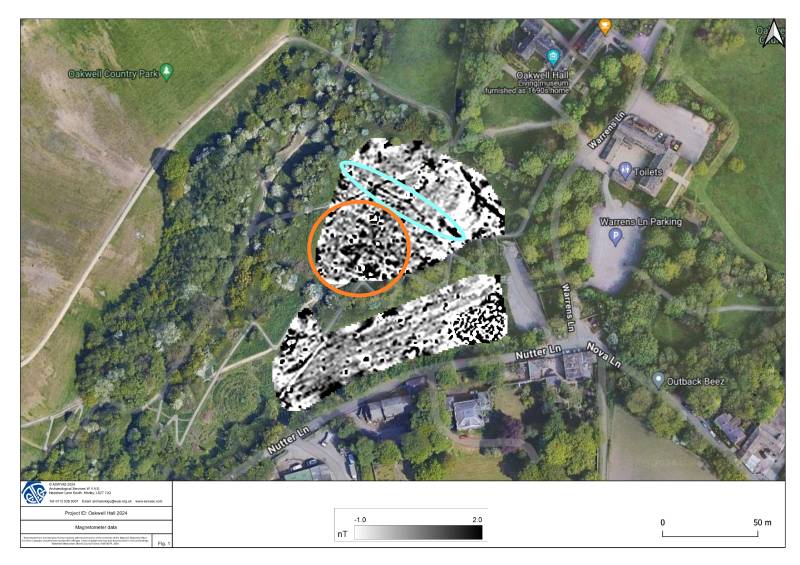
At Oakwell the results of this survey are not overly attractive. There are only a few results to make note of. The first is in the middle left of the field (highlighted in orange). These dots and jumbled readings are likely picking up on coal mining and shallow pits that have been dug over the course of the last few hundred years. This is not unexpected as Gomersal Colliery is only a few hundred meters away.
The other feature that is visible in these results is the linear feature that crosses the top of the field from northwest to southeast (highlighted in blue). This is likely an old field boundary where the south field was once split into two or more fields, likely when the area was used as farmland.
The keen eyed of you may have also spotted the strange thing that is happening in the bottom right of the image. This is rubble that was placed in the Overflow car park to stop cars sinking in the mud!
Resistivity
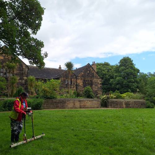
The second technique used on the site is Electrical Resistivity. The science behind this technique is based on the simple fact that the damper the soil is, the more electricity it is able to conduct. The conduciveness of the soil is measured by placing two 'remote' probes that remain stationary in the ground at a distance from the grid you will be surveying. Then attaching these electrodes by cables to a resistivity meter. This has two 'mobile' probes fixed to a frame which can be inserted into the ground. The resistivity meter then measures the varying degrees of resistance to a current passed between the two sets of electrodes. Silted up ditches or filled in pits retain more moisture which means the electricity will travel quicker. Whereas a stone wall or a road mean that the electricity will meet more resistance and travel slower.
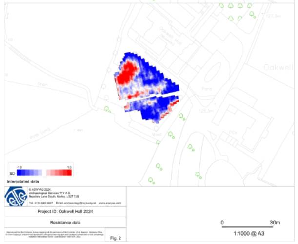
The red areas on the map above show where the electricity met the most resistance through the soil. Likely meaning that there are rocks or surfaces present. There are two distinct features that have come out of these results. The first on the left of the image are the remains of a large building. This building was partially excavated by archaeologists in the 1970's and can be seen on an 1806 map of Oakwell labelled as a farm building.
The second feature ruins on the right had side of the image close to the moat. A small portion of this building was also found during the 1970's excavations and is believed to be possibly a 12th century building predating the Hall.
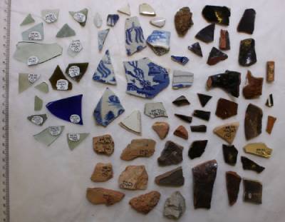
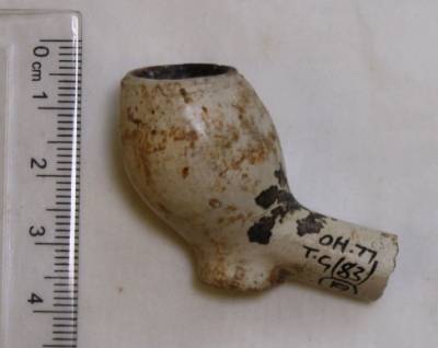
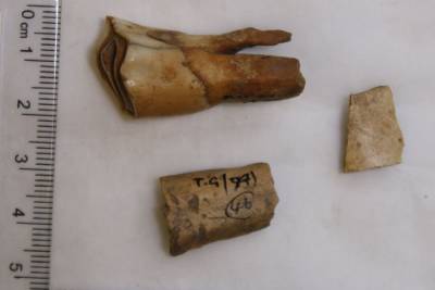
The Geophysics undertaken in these two, relatively small, fields next to the Hall have revealed an abundance of history hidden just below our feet. Archaeologists go on to use results from surveys like these to help decide whether and where to excavate. There have been a number of excavations that have taken place at Oakwell, all of which have uncovered pottery, glass, smoking pipes, animal bones and even shoes! Some of these brilliant finds are on display in the buttery at the Hall so you can see them for yourself.
Many thanks to West Yorkshire Archaeological Services .